

In the realm of land development, construction, and urban planning, understanding the lay of the land is paramount. Enter Topographical Surveys – a crucial tool in the lives of engineers, architects, and developers alike. These surveys provide a detailed and accurate representation of the terrain, offering invaluable insights that shape project decisions and outcomes.
At XP Surveys, we recognise the indispensable nature of topographical surveys and advocate for their utilisation in various projects.
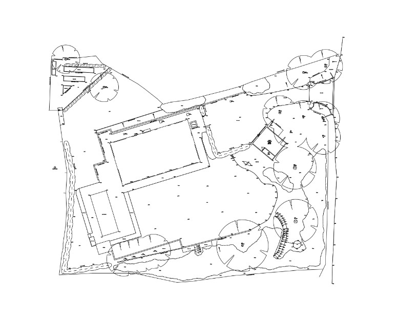
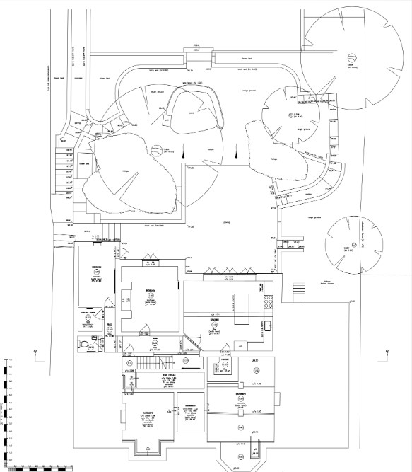
What Is A Topographical Survey?
A topographical survey (commonly known in the property development world as a ‘topo survey’) is a comprehensive and accurate assessment of a site or section of land, which considers all potential considerations that relate to a specific planned future development.
Topography is the study of the natural and artificial features of a landscape. Natural topographical features include terrain – the inclines, mound, and hollows of the land – as well as natural growth such as isolated trees and areas of woodland or scrub. They will also include bodies of water, including rivers and streams, ponds, and lakes.
Artificial topographical features are man-made: roads and paths, boundaries, buildings and other structures, street signs, lighting and furniture, and visible services (manhole covers, power lines, telephone cabinets).
Topographical surveys are 3-dimensional (height being an important measurement, not just grid line position), and will often be related to GPS position and/or Ordnance Survey references. CAD software is the widely accepted industry standard that allows accurate 3D mapping to be saved digitally, which can then be outputted in a variety of 3D and 2D views as required.
What Is The Purpose Of A Topographical Survey?
When a topographical survey is requested, there is always a potential development being considered – e.g. a residential or commercial property development.
The purpose of the topo survey is to assess all limitations and considerations relating to the site in question, to allow the architect or property developer to assess the feasibility of the proposed development, as well as decide what can and can’t be done, bearing in mind the findings of the topo survey.
Do I Need A Topographical Survey?
If your project is relatively small – for example, a house extension – it’s unlikely a full topographical survey will be needed. Smaller projects that might require a topographical survey include moving or establishing boundaries.
For larger projects, however, planning authorities will require a topographical survey as they will refer to it for considerations such as understanding the visual and environmental impact of the development and how it will connect with existing infrastructure and services.
The 5 Key Benefits Of Topographical Surveys
Now you know what topo surveys are, let’s look into the 5 key benefits.
- Enhanced Project Management: With accurate topographical data at hand, project planning becomes more efficient and effective. Engineers and planners can identify potential challenges and opportunities early in the process, allowing for proactive problem-solving and risk mitigation strategies.
- Improved Design Accuracy: Topographical surveys serve as the foundation for precise design work. Architects and engineers rely on this data to create site plans, grading designs, and infrastructure layouts that seamlessly integrate with existing landscapes.
- Optimal Resource Allocation: Efficient resource allocation is key to project success and cost-effectiveness. Topographical surveys enable stakeholders to allocate resources – such as materials, labour, and equipment – more effectively by providing insights into site conditions and requirements.
- Regulatory Compliance and Environmental Stewardship: In today’s regulatory landscape, compliance with environmental regulations is non-negotiable. Topographical surveys play a crucial role in ensuring projects adhere to applicable regulations and environmental standards.
- Enhanced Safety Measures: Safety is paramount in any construction project. Topographical surveys help identify potential safety hazards and risks associated with terrain, enabling proactive implementation of safety measures and protocols.
Measured Building Surveys vs Topo Surveys
In layman’s terms, a topo survey is an accurate, detailed, and thorough site or land survey, more concerned on the potential of the site than it is concerned about any existing buildings on that site.
A measured survey, by contrast, is focused on the existing building(s), and so is more appropriate when renovating or extending an existing property, than the overall potential of the plot the property is located on. Many construction works, such as large extensions or new builds, benefit from having both a topographical and measured building survey so that architects and planners can determine how the alterations sit within the site.
Why Choose XP Surveys?
- Accuracy: If you’re planning to put down foundations within millimetres of a mains water feed, electric cable, or sewer, you need to know your measurements are accurate! XP Surveys use technology which is accurate to + or – 2mm.
- Thoroughness: Also known as attention to detail – there’s no point researching 9 out of 10 important considerations and leaving 1 or 2 major issues out of the report, that would scupper the proposed development in the late stages of the planning application. Companies conducting a topographical survey service need to consider every possible aspect that could constrain or even prevent the proposed development. A good topo survey professional will be collaborative and consult with a variety of other specialised where required.
Service Levels: Construction projects have deadlines and involve a complex network of different professionals and organisations, including architects, council planning departments, construction companies, and clients. Good quality service aspects are an important consideration when selecting a firm to conduct a topo survey.
Conclusion
In the realm of land development and construction, knowledge is power – and topographical surveys provide the insights needed to navigate the terrain with confidence. From precise terrain understanding to enhanced project planning and regulatory compliance, the benefits of topographical surveys are undeniable.
At XP Surveys, we support the utilisation of these surveys to empower our clients with the information they need to achieve their project goals efficiently, responsibly, and safely. Harnessing the power of topographical surveys, we pave the way for successful projects that coordinate with the natural landscape while meeting the needs of the built environment.
Ben Richards – Founder
XP Surveys
Comments